 |
| Baikonur Credit: © Mark Wade. 38,169 bytes. 668 x 527 pixels. |
| astronautix.com | Baikonur |
|
| Baikonur Credit: © Mark Wade. 38,169 bytes. 668 x 527 pixels. |
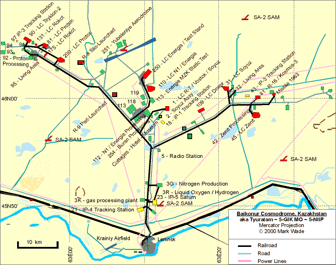
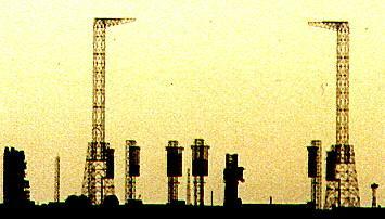
Russia's largest cosmodrome, the only one used for manned launches and with facilities for the larger Proton, N1, and Energia launch vehicles. The spaceport ended up on foreign soil after the break-up of Soviet Union. The official designations NIIP-5 and GIK-5 are used in official Soviet histories. It was also universally referred to as Tyuratam by both Soviet military staff and engineers, and the US intelligence agencies. Since the dissolution of the Soviet Union the Russian Federation has insisted on continued use of the old Soviet 'public' name of Baikonur. In its Kazakh (Kazak) version this is rendered Baykonur.
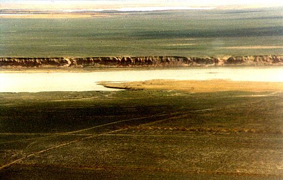 | Syr Darya River - Syr Darya River, south of Baikonur Credit: © Mark Wade. 44,280 bytes. 581 x 369 pixels. |
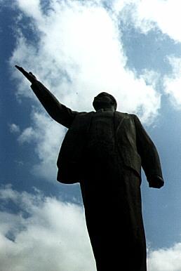
Leninsk (Site 10), located on the Syr Darya River along the main train line, was the main living area of the cosmodrome. It peak population was from 120,000 to 150,000. The traditional names for the areas of the cosmodrome were named as looking north from Leninsk: 'Left flank'; 'Right flank'; and 'Centre'.
The '9th Centre' - consisted of the town of Leninsk its living and cultural centres , Krainiy Airport, Moscow Aviation Institute's S Ordzhonikidze School, and the television centre. The administrative centre for the cosmodrome was in the town itself.
 | Leninsk - Lenin statue in main square of Leninsk Credit: © Mark Wade. 12,561 bytes. 258 x 386 pixels. |
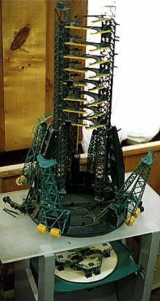
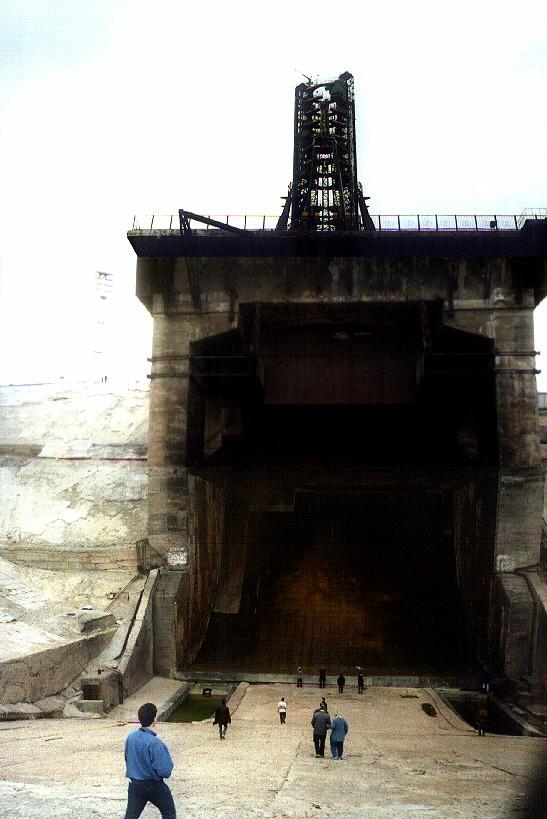
The 'Centre' or 'Korolev' area included facilities for the projects of Korole'v OKB-1. It includes the R-7/Vostoi/Soyuz 'Gagarin' launch pad (the first built at the cosmodrome) and the massive N-1 moon program facilities (later converted to use in the Energia-Buran program). It is located 30 km north of Leninsk. It consists of the First and Second Centres with the Gagarin pad, MIK (spacecraft/Soyuz assembly building), hotel, guest cottages, museum, and the cottages occupied by Gagarin and Korolev (now museums). Other facilities include the N-1/Energia launch complexes, including LC-110 (two launch pads), the single TK combination pad-test stand developed for launch and static test of the Energia rocket, and the cryogenics centre with 12 m diameter tanks for LOX, LH2, and gaseous N2 and He (400 atmosphere storage). The TK is 40 km from Leninsk and 5 km from LC 110.
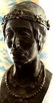 | Tyuratam aborigine - First inhabitants of Baikonur area - reconstruction from skeletal remains by famous Soviet 'face finder' Gerasimov. Credit: © Mark Wade. 6,288 bytes. 108 x 208 pixels. |
The 'Right Flank' or 'Yangel Arm' included facilities primarily for products of Yangel's design bureau. It was located 50 km from Leninsk. It includes a second R-7 pad, used as a backup pad for manned and planetary launches. 10 km south of this is the Zenit pad. This included two launch pads, a cryogenics centre, and fifty technological systems. The pad was capable of automatic launch of Zenit and was rated for the manned launches that were planned using the Zenit vehicle.
 | Energia launch pad - Energia launch complex Credit: © Mark Wade. 15,544 bytes. 355 x 202 pixels. |
Council of Chief designers approval to proceed with development of R-7.
Council of Ministers selects Tyuratam for ICBM test site. The first 30 construction workers arrive at Tyuratam. The town founded at the rail staion is called Zarya (Dawn). The name will be changed to Leninsk in January 1958, but Zarya will remain the call sign of Soviet ground control.
 | R-7 launch complex 1 - Model of R-7 launch complex 1 Credit: © Mark Wade. 27,438 bytes. 231 x 434 pixels. |
 | Baikonur airfield - Baikonur airfield with Su-7 gate guardian. Credit: © Mark Wade. 16,755 bytes. 425 x 213 pixels. |
After third attempt in three days to launch R-7 8K71 M1-6, the rocket is pulled from the pad. It is found that a nitrogen scavenging valve was installed backwards.
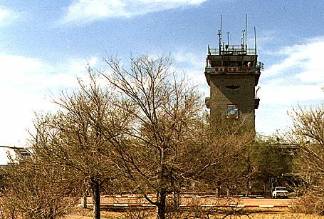 | Baikonur airfield - Baikonur airfield control tower. Credit: © Mark Wade. 47,393 bytes. 455 x 307 pixels. |
Planned August launch rescheduled after failure of American lunar probe on August 17. Inability to complete final tests of the new engines and malfunctions during pre-launch preparations indicated a lot of work had to be done on the new launch vehicle before the first launch could be attempted.
 | Soyuz LC-1 Credit: © Mark Wade. 22,528 bytes. 274 x 410 pixels. |
U.S.S.R. announced that it would launch a series of "more powerful and improved rockets. (Article in Red Star timed to coincide with first firing of new rocket series in the Pacific.)
 | Soyuz LC-1 Credit: © Mark Wade. 61,244 bytes. 547 x 819 pixels. |
The launch was delayed due to malfunctions during prelaunch service.
The launch was delayed due to malfunction of the RKS system of the Stages 1/2's control system during pre-launch service.
 | World Credit: © Mark Wade. 5,555 bytes. 445 x 304 pixels. |
The launch attempt was abandoned due to a launch vehicle malfunction during pre-launch preparations.
Stays on pad until 12 December for facilities checks. Photographed by US reconnsat on 11 December. 1M1 mockup scrapped in 1975.
A September 1968 flight test was planned. However the first stage LOX tank developed hairline cracks during ground tests. 4L was removed from the pad in June 1968. The first stage was cannibalized; the upper stages were incorporated into the 1M1 mockup for further training of the launch crews.
Block D stage exploded on pad, killing three people. Booster and 7K-L1 spacecraft were still intact however.
The N1 mockup was again erected on the pad, in order to conduct tests of the L1S payload in advance of the availability of the 3L launch vehicle.
The 3L vehicle, without its payload (which was on the 1M1 mockup), is erected on the pad to test engine systems.
This was the first new launch vehicle erection activity detected by US reconnsats after the destruction of pad 110 east in the July launch failure. The all-white launch vehicle, with no payload, is believed to be either N1 mockup 1M1 or flight vehicle 6L.
US reconnsat detects N1 being installed on the pad. It remained there, without payload, at least through 4 June.
Dual test of TKS-VA manned capsule. Shutdown of the launch vehicle on the pad triggered the launch escape system, which pulled the top capsule away from the booster. The parachute system failed and the capsule crashed to the ground. The lower capsule remained in the rocket. The top capsule was to have been manned, but the inability to demonstrate two consecutive failure free launches of the Proton/TKS-VA combination made that impossible.